Category:East Brent
Jump to navigation
Jump to search
English: East Brent is a village and civil parish, close to Brent Knoll, and the M5 motorway, west of Axbridge, in the Sedgemoor district of the county of Somerset, in the south-west of England. The parish includes the hamlets of Rooks Bridge and Edingworth.
village in Somerset, England  | |||||
| Upload media | |||||
| Instance of | |||||
|---|---|---|---|---|---|
| Location | Sedgemoor, Somerset, South West England, England | ||||
 | |||||
Subcategories
This category has the following 4 subcategories, out of 4 total.
Media in category "East Brent"
The following 200 files are in this category, out of 408 total.
(previous page) (next page)-
 A gap from a gap - geograph.org.uk - 5891775.jpg 2,231 × 1,650; 1.73 MB
-
 A home sweet home of the future^ - geograph.org.uk - 5891772.jpg 2,304 × 1,704; 1.69 MB
-
 A little hop onto the bus - geograph.org.uk - 5889479.jpg 1,704 × 2,304; 2.07 MB
-
 A little room for recreation - geograph.org.uk - 5891759.jpg 2,304 × 1,704; 1.59 MB
-
 A mention of the past - geograph.org.uk - 5892924.jpg 2,304 × 1,704; 1.7 MB
-
 A short game - geograph.org.uk - 4829373.jpg 2,304 × 1,704; 1.67 MB
-
 A shorter route to Pill Road - geograph.org.uk - 5891762.jpg 1,704 × 2,304; 2.11 MB
-
 A swan on the River Mark Yeo - geograph.org.uk - 3894116.jpg 1,024 × 768; 255 KB
-
 A taste of Cornwall in Somerset - geograph.org.uk - 1691903.jpg 640 × 480; 202 KB
-
 A Welcome Break - geograph.org.uk - 1691870.jpg 640 × 480; 225 KB
-
 A370, Bridgwater Road at East Brent - geograph.org.uk - 3801752.jpg 640 × 480; 285 KB
-
 A38 bridge over M5 at Sedgemoor - geograph.org.uk - 2496925.jpg 640 × 480; 43 KB
-
 A38 heading east - geograph.org.uk - 4251708.jpg 640 × 480; 65 KB
-
 A38 near Brent Knoll - geograph.org.uk - 2990070.jpg 640 × 452; 100 KB
-
 A38 towards Bristol - geograph.org.uk - 4251711.jpg 640 × 480; 68 KB
-
 Access road to Sedgemoor Services - geograph.org.uk - 5608889.jpg 1,024 × 768; 266 KB
-
 Across the fort - geograph.org.uk - 5245886.jpg 2,304 × 1,704; 1.53 MB
-
 Across to Willow Farm - geograph.org.uk - 5891671.jpg 2,304 × 1,704; 1.71 MB
-

-
 Anti-windfarm banner, Rooks Bridge - geograph.org.uk - 3893395.jpg 1,024 × 783; 206 KB
-
 Approaching East Brent Roundabout - geograph.org.uk - 4251697.jpg 640 × 480; 78 KB
-
 Approaching Rooks Bridge - geograph.org.uk - 5891676.jpg 2,304 × 1,704; 1.6 MB
-
 At the heart of Rooks Bridge - geograph.org.uk - 5892932.jpg 2,304 × 1,704; 1.33 MB
-
 Beaconsfield House, Rooks Bridge - geograph.org.uk - 3049250.jpg 640 × 433; 55 KB
-
 Between Brent Knoll and Wavering Down - geograph.org.uk - 5245871.jpg 2,304 × 1,704; 1.5 MB
-
 Brent House Hotel - geograph.org.uk - 4584468.jpg 1,024 × 768; 180 KB
-

-
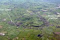
 Brent Knoll from the air - geograph.org.uk - 5110351.jpg 1,152 × 786; 275 KB
-
 Brent Knoll Inn, East Brent - geograph.org.uk - 3855810.jpg 1,024 × 768; 125 KB
-
 Brent Road rhyne - geograph.org.uk - 4829363.jpg 1,704 × 2,304; 1.92 MB
-
 Bridge over the River Axe, Whitehouse Lane, Loxton - geograph.org.uk - 2379669.jpg 4,000 × 3,000; 2.74 MB
-
 Bristol Road (A38) near East Brent - geograph.org.uk - 4251702.jpg 640 × 480; 64 KB
-
 Brock's Pill Rhyne - geograph.org.uk - 2086503.jpg 480 × 640; 93 KB
-

-
 Cattle in a field - geograph.org.uk - 4805773.jpg 1,024 × 768; 108 KB
-
 Chapel Road, Rooks Bridge - geograph.org.uk - 3049253.jpg 640 × 423; 57 KB
-
 Chapel Road, Rooks Bridge - geograph.org.uk - 5975928.jpg 1,600 × 1,107; 986 KB
-
 Church Office - geograph.org.uk - 4829327.jpg 2,304 × 1,704; 1.46 MB
-
 Churchyard Cross and School, East Brent - geograph.org.uk - 2422405.jpg 768 × 1,024; 251 KB
-
 Cottage beside River Mark Yeo - geograph.org.uk - 3894141.jpg 1,024 × 768; 255 KB
-
 Cottages on Brent Road - geograph.org.uk - 5734201.jpg 1,600 × 1,200; 390 KB
-
 Cottages on Strowlands, East Brent - geograph.org.uk - 3855830.jpg 1,024 × 768; 178 KB
-
 Cows near Laurel Farm - geograph.org.uk - 3628575.jpg 640 × 427; 54 KB
-

-

-

-

-

-
 Drain beside Bristol Road - geograph.org.uk - 3455794.jpg 640 × 480; 131 KB
-
 Drain beside Bristol Road - geograph.org.uk - 3455811.jpg 640 × 480; 98 KB
-
 Drainage channel near Sedgemoor Services - geograph.org.uk - 5608890.jpg 1,024 × 768; 288 KB
-
 Dulhorn camp site - geograph.org.uk - 2456125.jpg 640 × 480; 64 KB
-
 Dulhorn Farm - geograph.org.uk - 2942688.jpg 800 × 399; 185 KB
-
 Dulhorn Farm - geograph.org.uk - 5645411.jpg 1,024 × 683; 285 KB
-
 East Brent , Ash Tree House - geograph.org.uk - 4425974.jpg 4,288 × 2,848; 4.99 MB
-
 East Brent , Brent Road - geograph.org.uk - 4425971.jpg 4,288 × 2,848; 4.89 MB
-
 East Brent , Brent Road - geograph.org.uk - 4425976.jpg 4,288 × 2,848; 4.28 MB
-
 East Brent , Burton Row - geograph.org.uk - 4425956.jpg 4,288 × 2,848; 4.93 MB
-
 East Brent , Church of England First School - geograph.org.uk - 4417087.jpg 3,858 × 2,562; 4.89 MB
-
 East Brent , Church Road - geograph.org.uk - 4417082.jpg 4,288 × 2,848; 5.88 MB
-
 East Brent , Clocktower Wellness Centre - geograph.org.uk - 4417088.jpg 4,171 × 2,770; 6.16 MB
-
 East Brent , Grassy Field - geograph.org.uk - 4425944.jpg 4,288 × 2,848; 5.05 MB
-
 East Brent , Grassy Field ^ Horses - geograph.org.uk - 4425966.jpg 4,288 × 2,848; 5.68 MB
-
 East Brent , Grassy Field ^ Llamas - geograph.org.uk - 4425932.jpg 4,288 × 2,848; 4.68 MB
-
 East Brent , Grassy Field ^ Sheep - geograph.org.uk - 4417089.jpg 4,114 × 2,732; 5.09 MB
-
 East Brent , M5 Motorway - geograph.org.uk - 6283762.jpg 6,000 × 4,000; 4.49 MB
-
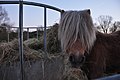 East Brent , Pony - geograph.org.uk - 4425960.jpg 4,288 × 2,848; 5 MB
-
 East Brent , St Mary's Church - geograph.org.uk - 4417084.jpg 2,848 × 4,288; 6.61 MB
-
 East Brent , St Mary's Church - geograph.org.uk - 4417086.jpg 3,963 × 2,632; 6.81 MB
-
 East Brent , The Old Rectory - geograph.org.uk - 4417083.jpg 4,288 × 2,848; 5.64 MB
-
 East Brent , Village Green - geograph.org.uk - 4425980.jpg 4,288 × 2,848; 6.22 MB
-

-
 East Brent from the Knoll - geograph.org.uk - 5245879.jpg 2,304 × 1,704; 1.59 MB
-
 East Brent play area - geograph.org.uk - 4829384.jpg 2,304 × 1,704; 1.76 MB
-
 East Brent pre-school - geograph.org.uk - 2942695.jpg 800 × 600; 313 KB
-
 East Brent Village Hall - geograph.org.uk - 2456631.jpg 640 × 480; 97 KB
-
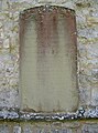
 East Brent War Memorial (Somerset) - geograph.org.uk - 4790578.jpg 480 × 640; 169 KB
-
 East Brent, James Heappey election poster - geograph.org.uk - 4470912.jpg 3,914 × 2,671; 7.5 MB
-

-
 East Brent, St Mary's churchyard - geograph.org.uk - 4470921.jpg 3,679 × 2,456; 4.68 MB
-

-

-
 East Brent, St Mary's, a predominantly 15th century church - geograph.org.uk - 4470899.jpg 4,645 × 2,825; 6.74 MB
-
 East Brent, St Mary's, a predominantly 15th century church - geograph.org.uk - 4470919.jpg 3,679 × 2,456; 4.19 MB
-
 East Brent, St Mary's, a predominantly 15th century church - geograph.org.uk - 4470924.jpg 3,818 × 2,454; 3.53 MB
-

-
 East Brent, St Mary's, The 1637 nave ceiling - geograph.org.uk - 4470942.jpg 5,520 × 3,680; 7.74 MB
-
 East Brent, St. Mary's Church, 15th century bench ends 1 - geograph.org.uk - 4561026.jpg 2,417 × 3,261; 3.91 MB
-
 East Brent, St. Mary's Church, 15th century bench ends 2 - geograph.org.uk - 4561028.jpg 2,527 × 3,363; 4.06 MB
-
 East Brent, St. Mary's Church, 15th century bench ends 3 - geograph.org.uk - 4561030.jpg 2,480 × 3,505; 3.84 MB
-
 East Brent, St. Mary's Church, 15th century bench ends 4 - geograph.org.uk - 4561032.jpg 1,507 × 1,959; 1.78 MB
-
 East Brent, St. Mary's Church, 15th century bench ends 5 - geograph.org.uk - 4561035.jpg 3,471 × 2,078; 3.3 MB
-
 East Brent, St. Mary's Church, 15th century bench ends 6 - geograph.org.uk - 4561036.jpg 1,894 × 2,098; 1.82 MB
-
 East Brent, St. Mary's Church, 15th century bench ends 7 - geograph.org.uk - 4561039.jpg 3,689 × 2,787; 4.48 MB
-
 East Brent, St. Mary's Church, 15th century bench ends 8 - geograph.org.uk - 4561041.jpg 3,550 × 2,241; 3.2 MB
-

-
 East Brent, St. Mary's Church, Stained glass window - geograph.org.uk - 4561058.jpg 3,655 × 2,415; 4.67 MB
-
 East Brent, St. Mary's Church, The Chancel Ceiling - geograph.org.uk - 4561082.jpg 5,500 × 3,650; 7.44 MB
-
 East Brent, St. Mary's Church, The Chancel Ceiling - geograph.org.uk - 4561083.jpg 4,629 × 2,652; 5.66 MB
-
 East Brent, St. Mary's Church, The Church Organ - geograph.org.uk - 4561073.jpg 5,520 × 3,680; 7.54 MB
-
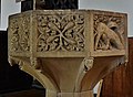
 East Brent, St. Mary's Church, The Font - geograph.org.uk - 4561060.jpg 5,460 × 3,586; 7.77 MB
-
 East Brent, St. Mary's Church, The Font - geograph.org.uk - 4561062.jpg 3,678 × 2,456; 4.68 MB
-
 East Brent, St. Mary's Church, The Font - geograph.org.uk - 4561063.jpg 1,249 × 911; 594 KB
-
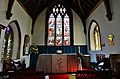
 East Brent, St. Mary's Church, The Nave - geograph.org.uk - 4561054.jpg 4,931 × 2,983; 4.5 MB
-
 East Brent, St. Mary's Church, The Nave - geograph.org.uk - 4561056.jpg 3,678 × 2,456; 4.11 MB
-
 East Brent, St. Mary's Church, The Nave from the Chancel - geograph.org.uk - 4561081.jpg 5,520 × 3,680; 7.33 MB
-
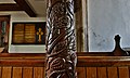
 East Brent, St. Mary's Church, The pulpit made in the 1630s - geograph.org.uk - 4561074.jpg 4,468 × 2,923; 6.03 MB
-
 East Brent, St. Mary's Church, The pulpit made in the 1630s - geograph.org.uk - 4561077.jpg 5,137 × 3,247; 7.41 MB
-
 East Brent, St. Mary's Church, The Reed Monument - geograph.org.uk - 4561066.jpg 3,590 × 3,320; 4.89 MB
-
 East Brent, St. Mary's Church, The Reed Monument detail - geograph.org.uk - 4561069.jpg 3,678 × 2,455; 3.29 MB
-
 East Brent, St. Mary's Church, The Reed Monument detail - geograph.org.uk - 4561070.jpg 5,234 × 3,182; 6.46 MB
-
 East Brent, St. Mary's Church, The Sanctuary - geograph.org.uk - 4561079.jpg 5,466 × 3,596; 7.61 MB
-
 East Brent, St. Mary's Church, The West Gallery of 1635 - geograph.org.uk - 4561046.jpg 5,390 × 3,474; 5.79 MB
-
 East Brent, St. Mary's Church, The West Gallery of 1635 - geograph.org.uk - 4561050.jpg 4,417 × 3,678; 6.79 MB
-
 East Brent, St. Mary's Church, The West Gallery of 1635 - geograph.org.uk - 4561052.jpg 5,004 × 3,021; 7.12 MB
-
 East Brent, Weston Road (A370) - geograph.org.uk - 3801746.jpg 640 × 480; 299 KB
-
 EastBrent2.jpg 4,284 × 2,892; 10.29 MB
-

-

-
 Edingworth Rhyne - geograph.org.uk - 2418847.jpg 640 × 462; 98 KB
-
 Electricity Power Lines, east of Strowlands - geograph.org.uk - 3855838.jpg 1,024 × 768; 153 KB
-
 Electricity sub station by the M5 - geograph.org.uk - 4739342.jpg 640 × 385; 42 KB
-
 Electricity sub-station, Edingworth Road - geograph.org.uk - 3856054.jpg 1,024 × 768; 198 KB
-

-
 Entrance gate, Brent Knoll - geograph.org.uk - 3854914.jpg 768 × 1,024; 248 KB
-

-

-

-

-

-
 Fading from history - geograph.org.uk - 4829158.jpg 1,704 × 2,304; 1.77 MB
-
 Farm access bridge on the River Mark Yeo - geograph.org.uk - 3894108.jpg 1,024 × 793; 233 KB
-
 Farm bridge over M5 south of Loxton - geograph.org.uk - 2685205.jpg 800 × 601; 315 KB
-
 Farm drive, East Brent - geograph.org.uk - 2086512.jpg 640 × 480; 118 KB
-
 Farm near Edingworth - geograph.org.uk - 2381187.jpg 4,000 × 3,000; 2.76 MB
-
 Farmland towards East Brent - geograph.org.uk - 3455798.jpg 640 × 480; 70 KB
-
 Farmland towards the M5 - geograph.org.uk - 3455802.jpg 640 × 480; 54 KB
-
 Fear God, Honour The King - geograph.org.uk - 4829243.jpg 1,704 × 2,304; 1.57 MB
-
 Field and drain alongside Pill Road - geograph.org.uk - 4806508.jpg 1,024 × 768; 195 KB
-
 Field at Prowses Steining - geograph.org.uk - 4804931.jpg 1,024 × 768; 227 KB
-
 Field to the east of White House Lane - geograph.org.uk - 3894747.jpg 1,024 × 764; 230 KB
-
 Field, Dulhorn - geograph.org.uk - 2456199.jpg 640 × 359; 74 KB
-

-

-
 Footbridge over the M5 - geograph.org.uk - 3322691.jpg 640 × 621; 48 KB
-
 Footbridge over the M5 - geograph.org.uk - 3322694.jpg 640 × 633; 35 KB
-
 Footpath - geograph.org.uk - 86681.jpg 640 × 426; 113 KB
-
 Footpath from White House Lane - geograph.org.uk - 2086247.jpg 640 × 367; 64 KB
-
 Footpath leading up towards the Northern edge of Brent Knoll - geograph.org.uk - 5062784.jpg 3,648 × 2,048; 2.02 MB
-
 Footpath to East Brent - geograph.org.uk - 4162591.jpg 1,024 × 768; 164 KB
-
 Footpath to East Brent - geograph.org.uk - 5730999.jpg 1,024 × 768; 221 KB
-
 Footpath to Knoll Farm - geograph.org.uk - 5734227.jpg 1,024 × 768; 184 KB
-
 Footpath to Rook's Bridge - geograph.org.uk - 4665009.jpg 1,024 × 768; 182 KB
-
 From Pill Road to Gills Lane - geograph.org.uk - 5891767.jpg 2,304 × 1,704; 1.8 MB
-
 Getting off the Bristol Road - geograph.org.uk - 5891685.jpg 1,704 × 2,304; 2.07 MB
-
 Glastonbury Tor from Brent Knoll - geograph.org.uk - 5760876.jpg 2,524 × 1,729; 4.31 MB
-
 Goal posts, Dulhorn Farm - geograph.org.uk - 5649719.jpg 1,024 × 683; 265 KB
-
 Golden Jubilee stone and toposcope - geograph.org.uk - 5245861.jpg 2,304 × 1,704; 1.76 MB
-
 Grazing west of Bristol Road (A38) - geograph.org.uk - 4251696.jpg 640 × 480; 71 KB
-
 Half a mile from the church - geograph.org.uk - 4829157.jpg 1,704 × 2,304; 1.45 MB
-
 Hawker downed - geograph.org.uk - 5891681.jpg 2,304 × 1,704; 1.79 MB
-
 Holy, Holy, Holy, Alleluia, Alleluia^ - geograph.org.uk - 4829234.jpg 2,304 × 1,704; 1.71 MB
-
 House on Church Road - geograph.org.uk - 3855476.jpg 1,024 × 768; 162 KB
-
 House on Old Bristol Road - geograph.org.uk - 3855815.jpg 1,024 × 768; 195 KB
-
 House, near North Yeo Farm - geograph.org.uk - 3894725.jpg 1,024 × 768; 164 KB
-
 Houses at Rooks Bridge - geograph.org.uk - 5111654.jpg 3,072 × 1,848; 1.01 MB
-
 Houses on Brent Road - geograph.org.uk - 3855490.jpg 1,024 × 768; 137 KB
-
 In view of the knoll - geograph.org.uk - 4829170.jpg 2,304 × 1,704; 1.74 MB
-
 Inside the ramparts of the Iron Age fort on top Brent Knoll - geograph.org.uk - 5062790.jpg 3,648 × 2,048; 2.31 MB
-
 Jubilee celebrations here - geograph.org.uk - 5245836.jpg 1,704 × 2,304; 1.99 MB
-
 Jubilee Stone, Brent Knoll - geograph.org.uk - 2178603.jpg 640 × 480; 66 KB
-
 Just the one goal - geograph.org.uk - 5891756.jpg 2,304 × 1,704; 1.81 MB
-
 Kennels and cattery - geograph.org.uk - 2942673.jpg 800 × 600; 335 KB
-
 Knoll Farm - geograph.org.uk - 5734213.jpg 1,024 × 768; 173 KB
-
 Lake House Cottages - geograph.org.uk - 3855806.jpg 1,024 × 768; 122 KB
-
 Lakehouse Lane - geograph.org.uk - 3855799.jpg 1,024 × 769; 223 KB
-
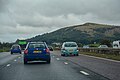
 Looking South on the M5 motorway - geograph.org.uk - 3153310.jpg 1,024 × 720; 127 KB
-
 Looking toward Portishead - geograph.org.uk - 6074585.jpg 1,600 × 1,200; 249 KB
-

-

-

-
 Lying with the daisies - geograph.org.uk - 4829160.jpg 1,704 × 2,304; 2.26 MB
-
 M5 - geograph.org.uk - 3322685.jpg 640 × 361; 27 KB
-
 M5 and A38 from the air - geograph.org.uk - 5110612.jpg 1,078 × 1,338; 310 KB
-
 M5 east of Prospect Farm - geograph.org.uk - 3181494.jpg 3,170 × 2,383; 1.28 MB
-
 M5 Motorway, near Edingworth - geograph.org.uk - 3449115.jpg 1,024 × 751; 164 KB
-
 M5 near Brent Knoll - geograph.org.uk - 2032539.jpg 2,850 × 1,726; 1.61 MB
-
 M5 near Edingworth - geograph.org.uk - 1996264.jpg 1,024 × 664; 206 KB
-
 M5 near Rooks Bridge - geograph.org.uk - 3628572.jpg 640 × 427; 49 KB
-
 M5 near Webbington - geograph.org.uk - 2032457.jpg 2,979 × 1,916; 2.21 MB
-
 M5 northbound - geograph.org.uk - 1654048.jpg 640 × 480; 88 KB
-

-
 M5 northwest of Pear Tree Farm - geograph.org.uk - 3181480.jpg 3,469 × 2,554; 1.52 MB
-
 M5 southbound - geograph.org.uk - 3626258.jpg 1,821 × 1,141; 985 KB
-
 M5 southbound approaching Sedgemoor Services - geograph.org.uk - 4681116.jpg 2,132 × 1,412; 1.15 MB
-
 M5 southbound near East Brent - geograph.org.uk - 4251706.jpg 640 × 477; 78 KB
-
 M5 southbound near East Brent - geograph.org.uk - 4681130.jpg 2,052 × 1,211; 1.06 MB
-
 M5 southbound near East Brent, Somerset - geograph.org.uk - 4681124.jpg 2,021 × 1,266; 790 KB
-
 M5 southbound, 1 mile to Sedgemoor Services - geograph.org.uk - 4681105.jpg 2,048 × 1,328; 1.33 MB
-
 M5 tourist information signs - geograph.org.uk - 4681137.jpg 2,128 × 1,328; 1.37 MB


_near_East_Brent_-_geograph.org.uk_-_4251702.jpg)

_-_geograph.org.uk_-_6383374.jpg)


_-_geograph.org.uk_-_4790578.jpg)


_-_geograph.org.uk_-_3801746.jpg)


_services_-_geograph.org.uk_-_3517472.jpg)


_-_geograph.org.uk_-_4251696.jpg)


_-_geograph.org.uk_-_3517648.jpg)


